| Tourentyp | |
| Lat | |
| Lon | |
| Mitreisende | |
This summer I crossed the Alps and walked from Garmisch Patenkirchen to Brescia in Italy.
Total distance was round about 400km.
I was not so lucky with the weather for the first part of the hike but the further I walked into Italy the better the weather.
Just have a look at the pictures and enjoy.
Day No.1- Garmisch Patenkirchen to the Kreuzeckhaus
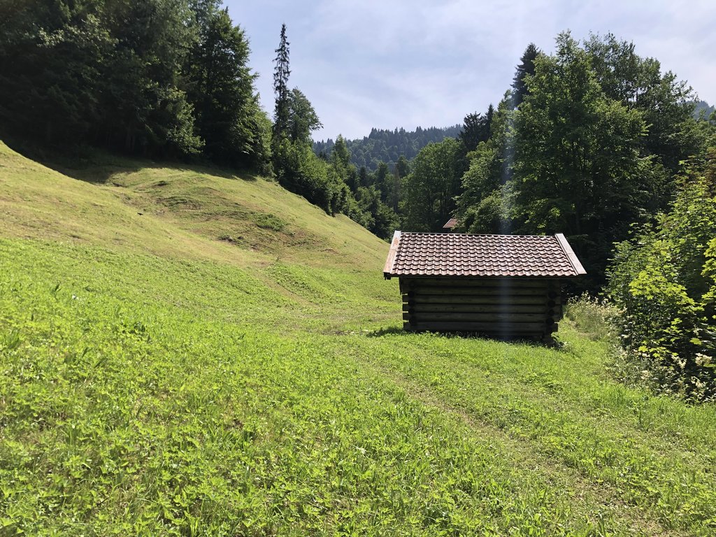
After leaving Garmisch and heading up the mountains, I had the great feeling that holiday had started. It was pretty hot and humid and it did not take long for a rain shower with a bit of thunder and lightning to try and spoil my day. Well my mood was so good that the weather gods didn´t stand a chance. I took shelter under the roof of the Trögel Hütte and continued when it all was over.

The view after leaving Garmisch
Day No.2- Kreuzeckhaus to Knorr Hütte
Walking down towards Partnach valley was lovely and I was surprised to meet no one. The Partnach valley itself is just beautiful and is one of the places that you are not sure if this is really Germany. Especially the upper part of the valley with wonderful views were I came from are well worth the walk. After my first beer at the Knorrhütte I decided it was enough for the day and just enjoyed another beer and some good food.

Beautiful Reintalanger. Yes this is Germany


Day No.3- Knorr Hütte to Inntal (border crossing Germany/Austria)
A bit cold in the morning but after the sun came out it became a great day with almost no clouds and lots of sun. After a short hour walk, I crossed the border into Austria and felt privileged for living in this part of the world where you can cross borders without anybody checking. No hassle, no visas or special permits. Do all of us realize how lucky we are?
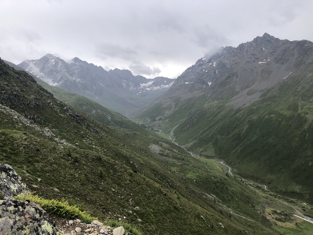
Anyhow, it was an easy walk down the Tillfussalm from where it went up for the next pass to go down towards the wide Inntal valley.

The Knorr Hütte early in the morning

View towards the nieder munde pass

The stream Leutascher Ache not far from the Tillfussalm

View from the nieder munde pass in the direction from where I came on the right side of the photo

The wide Inn Valley


Walking down into the Inntal it still looks pretty rough
Day No.4- Inntal to Kühtai
Yesterday from the top of the pass, it looked like a quick go towards the other side of the valley but it was almost noon until I reached Stams. From now on, it went all the way up to the top of the Pirchkogel. After coming down I found a nice place to pinch my tent and I decided that it was enough for that day.

Lovely Inn Valley early in the morning

I spend half the day hiking with Torben and Ties, photo taken close to the top of Pirschkogel


How beautiful this lake on the way down towards Kühtai

My camping spot
Day No.5- Kühtai to Winnebachsee Hütte
The first bit of the morning walk was still more or less ok. A bit further down I reached the Kühtai area where the landscape is “destroyed” just for the sake of skiing. After reaching the Finstertal reservoir, I was back in gentle alpine landscape again. Slowly the weather changed during the afternoon and it started to rain.
I reached the Winnebachsee Hütte in the clouds and was happy that they had a place to sleep for me and I could change for dry cloths and dry my wet stuff.

Next morning, I prefer hiking instead of horse riding

Kühtai, nice isn´t it?
On route towards Winnebachsee Hütte as the weather was still ok
Day No.6- Winnebachsee Hütte to Kaiseralm (Sölden)
Beautiful day and the it was a joy hiking. Close to the Amberger Hütte a farmer with a cow on the lease stopped me and asked if I could watch a new born calf that almost lay in a fast running stream.
Why do cows give birth at such a place?
Anyhow, the farmer came back 10 minutes later with a wheelbarrow and loaded the calf to take it to his “Alm”.
After the Amberg Hütte it went up towards the Atterkarjöchel. Not the most easy pass on the trail and I can imagine that people with fear of heights could end up being very unhappy.
After coming down I decided enough for today and I camped near a stream.

Winnebachsee Hütte early in the morning. Yesterday I almost bumped into the hut as it was barely seen due to rain and fog

Coming down the valley

Amberger Hütte

Above the Amberger Hütte

Last bit of glacier on my accent to the Atterkarjöchel
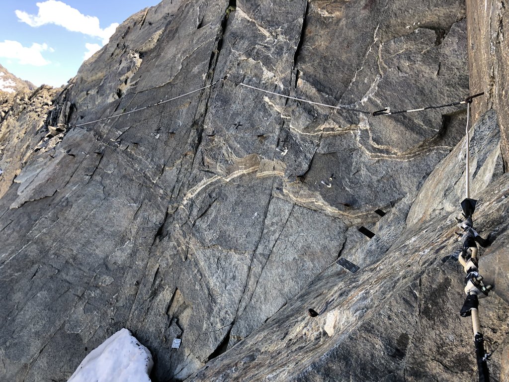
Not everybody’s favorite towards the top of the ridge

The ridge

View in direction of Kaiseralm

Preparing camp
Day No.7- Kaiseralm (Sölden) to Vent
This was the only day on the trail that I didn´t really like. Coming down towards Sölden was still ok, but the town itself was more like Disney Land to me. Between Zwieselstein and Vent some parts of the trail are along the road side which include tunnel crossing. Crazy like I am, I decided to do all on foot so there was no other option. I found a nice Pension in Vent and had a great pizza that made me forget all the negative moments along the road.

No need for comment

Sölden deep down the valley

No trespassing

On my way to Vent


My old school hotel in Vent

The hotel itself

Wauw that was a great fiesta at the end of the day
Day No.8- Vent to Bellavistahütte (border crossing Austria/Italy)
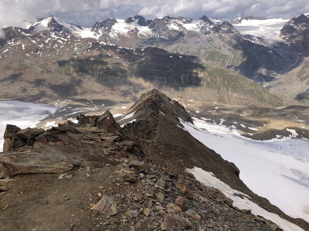
Nice early start with an early arrival at the Martin Busch Hütte. After a break, I continued for the highest part on the trail the Seikogel. Great views in all directions towards peaks and glaciers.
Ötzi the iceman was found not far from here and he crossed my mind quit a view times.
The last bit was a bit windy and I heard thunder from not too far away so I made a bit of a sprint towards the Bellavista Hütte.

An early start with great weather

Martin Busch Hütte in its lovely setting

Martin Busch Hütte again far down
Next few pictures are all from accent, top and decent of the Saykogel, the highest point of the whole trail. What will be left over of these glaciers in the next 10/20/30 years?


Punk is not dead!

Hiking up the valley towards Hochjoch
Day No.9- Bad weather resting day at Bella vista Hütte
Luckily, the bad weather hit me at this spot. What a great hut with a gorgeous kitchen and a special surprise, in the late afternoon the staff heats up a sauna.
Well I have seen and done a lot but never enjoyed a sauna on 2800 meters.

The Bella vista Hütte

My nice liitle room, luxury pure

Check out the sauna!
Day No.10- Bella vista Hütte to Schlanders (Süd Tirol)
This day I passed one of the most amazing lakes ever. Well just, check out the photos.
After that, it was half a day of decent towards Schlanders. I did not want to spend time looking for a place to stay in Schlanders so I filled up my water and found a great camping spot looking down on Schlanders.


The Vernagt Stausee


Where do these colours come from? Isn´t it beautiful? I spent quite some time just staring

After this lake called dark lake, it was down, down, down towards Schlanders


My camping spot close to Schlanders
Day No.11- Schlanders to Zirmbichlalm
A bit of a rainy day but looking back, it was not that bad, especially the humid smell of forest and alpine meadows was nature at its best.
Walking up towards the Göflaner alm there were boards showing how the men in this area had been transporting marble down the mountain from the quarries for over the last 150 years. Huge blocks that they moved down with their bare hands, rope and oxen. I was impressed and shocked at the same time. How many of these men died at this brutal job? What an easy life and safe live we have compared to them!
At the end of the afternoon, the sun came out and I found a nice camping spot.

Little impression of Süd Tirol

An even better impression for a hungry hiker


The weather was not too good that afternoon

Camping at Zirmbichlalm
Day No.12- Zirmbichlalm to Martell Hütte
An easy day of walk but kind of rainy. It would rain for half an hour and after that it would be dry again and then things would repeat. As the view was not very good for a glacier crossing and a just over 3000-meter pass I decided to stay in the Martell Hütte and hope for good weather for tomorrow.

After a rainy day I arrived at the Martell Hütte
Day No.13- Martell Hütte to Lago di Pian Palu
It started with an easy glacier crossing and the accent towards the Fürkel Scharte through some snow that fell last night. All in all nothing special except for the trail finding that was non visible because of the snow. Luckily, I met up with a German guy called Holger on the Hut so we shared our “fear” together. Funny thing that I realized later on was that by crossing this pass we finally left the German speaking part of the Alps and ended up in the Italian only speaking Alps.
And before I forget to mention it the weather was great and the sun shone all day!! Maybe something to do with the real Italy? Ohhhhh bella Italia
At the end of the day I decided to camp once more and Holger continued for the next Hut or???
I would never find out.

Leaving the Martell Hütte early that morning with snow on the higher regions

The crossing of a minor glacier on our way to the top of the Fürkler Scharte

This pass really divides the German/Italian language


Hiking down the pass with great weather towards the village of Peio


With a close look you can find rifugio Cevedale on the right side of the photo

This is what it is all about


After a long and easy walk down we arrived at the small village of Peio
Day No.14- Lago di Pian Palu to Ponte di Legno
It would be an easy walking day with the sun being my friend. By mid-afternoon, I reached Ponte di Legno and found a nice little hotel and enjoyed dolce vita for the rest of the day.


Lago di Pian Palu

Looking back from where I came from the Forcellina di Montozzo pass

First presence of the tragical fighting during the first world war

I had to go down all the way

Down on the valley floor lies Ponte Di Legno


My very very old school hotel in Ponte di Legno

Dolce vita on the town square
Day No.15- Ponte di Legno to Rifugio Tonolini
The first part of the day was not very spectacular as the walk went through a heavy populated valley. After leaving this urban jungle, it went up the mountains again to pass a few reservoirs that would not be the last ones that I would see in Italy. Seems that Italians loved to build reservoirs. Maybe they checked it out years ago that green energy would be the thing!
After the reservoirs, it went up towards a pass with a lot of boulder hopping and great views.
At the end of the day, I showed up at Rifugio Tonolini and had a nice cold beer.

On my way up to the Passo di Premazoni I passed quit a few reservoirs


Mount Adamello


Finally the top after a long scramble

Some great views


Refugio Tonolini at the end of the day
Day No.16- Rifugio Tonolini to lago di Avolo
This would be the longest but also one of the most beautiful days on the trail. I really enjoyed the rough landscape of the Adamello Mountains especially higher up with a feeling of being alone and lost in time. Walking down the Poja valley towards the Rifugio Lissone was a dream.
I was in such a (hiking) flow that I just continued without realizing that it would be a steep climb up from Rifugio Lissone. Late that evening I pinched my tent close to a little lake at roughly 2500-meters (I will never know the correct altitude because I am one of these old school guys without altimeter). The temperatures were slightly minus that night as all grass was white that morning but it was the best sleeping I had on the whole trail.

The small but cosy Rifugio Tonolini in the early morning


Just some nice views along the way

Rifugio Gnutti (they serve a great espresso)

The only way is up

Climbing passo Miller

Almost did it

View from passo Miller towards the other side

Adamello glacier

Rifugio Prudenzini at the bottom of the valley

Up the next pass called passo di Poia

Looking backwards with the Adamello glacier

This way down please

The lovely Poia valley

Last views of Rifugio Lissone
One of these secret moments

That is where I came from

More First World War relicts

After a long day, I pinched my tent close to this lake

Day No.17- Lago di Avolo to rifugio Tita Secchi
Great weather. Nice views. Couldn´t be any better.
High up in the mountains there are lots of hide outs as left overs of the fighting in these part of the alps during the first world war.
I have been seeing them since the last couple of days but the area of Tita Secchi is just full of them.
Here and there, I passed names of men that died during this crazy war. Many of them just boys, 15,16,17,18,19 years old!

The trail to Rifugio Maria y Franco passes below the snow on the right side of the photo


Looking back from where I came close to the Rifugio

Rifugio Maria y Franco with the next pass in the background

Smiling (because life is good) on top of the Dernal pass with Rifugio Maria y Franco in the far background

View from the Dernal pass in the direction where the trail leads me

Looking back towards the Dernal pass roughly in the middle of the horizon


Remains of the first world war


Rifugio Tita Secchi
Day No.18- Rifugio Tita Secchi to bivacco Capanna Tita Secchi
Slowly the hike is leaving the high Alps and I am entering the foothills of the Alps before they hit the Italian plains. Route finding gets more difficult and more than once, I need to back track.
Walking up the higher part of the valley of Grigna was just awesome, undisturbed nature all around me.
At the end of the day, I camped close to the bivacco Capanna Tita Secchi and enjoyed the last rays of sun eating some Italian cheese that I bought from a framer.
Yes, life can be very very good.

What a day! As you can see, I am slowly leaving the “high” Alps for the foothills

Maria everywhere

Laghi di Ravenola at the point where the Grigna valley opens up

Farmers milking their cows on the middle of the road close to bivacco Capanna di Tita Secchi. I am sure that these cows have a happy life
Day No.19- Bivacco Capanna Tita Secchi to Lodrino
I felt great, the weather was great and the surroundings looked great my inner feeling told me that I had to climb the Corna Blacca. It was a bit of a climb and half way up I thought why did I not take the easy trail?
However, it was worth every bit of energy that I wasted. That white Mountain, the magnificent views and the almost scary trails on the backside of the mountain.
I had only one word left over after I did it, great!
Coming down lower it was slowly getting warm and I was happy to be able to walk in the shade.
I reached the hamlet of Vaghezza and was more than happy to have a cold beer at the local (only) sportsbar. When I finally reached Lodrino I only wanted to drink a coke…I could barely remember that coke could taste sooooooo good.
I tried to find a hotel or B&B in lodrino but there was no Hotel and the only B&B was full or didn´t want smelly hikers for one night only so the only thing I could do was cry or carry on.
I decided the last one was the better option.
So I camped somewhere in the woods and the only thing I could say was HOT.
I had to be in the tent otherwise the mosquitos would eat me alive but the deal I made was in a little sticky tent with sweat just pouring out of me. This was definatly the worse night on the trip.
In the middle of the night, I had to scream to chase the wild pigs from the area.
Yes, that is what they call adventure…Why don´t you read stuff like that in these fancy looking magazines?

Sunrise as I just got out of my tent

My camping spot


The same view but just before setting of

Corna Blacca had to be climbed
Next few pictures during my accent and decent of Corna Blacca


The village of Lavino

Street in Lodrino

Again Lodrino

My camping spot

Day No.20- Lodrino to Brescia
The last day became extremely hot and more than once that day I thought what am I doing here?
I made a very early start to make sure that I could do the major part of the climb up the first pass with the still moderate morning temperatures. I was shocked by all the cages all along the mountaintops that hunters use to catch migrating birds. I mean, for sure couple of hundred years ago this was an important source of protein for the people of this area. But in our modern times with more and more animals and birds becoming extinct this is a “sport” that should be forbidden.
Anyhow, it was so hot that I filled up at every water source I could find and every time I did I would start off with about 4 liters of water.
I hoped to spend my last night as a pilgrim in the monastery of Conche but due to Covid it was closed.
Therefore, the only thing I could do was continue to Brescia were I arrived early that evening.
Finally, I could take a shower and change for something not so smelly.
The only sad thing was that I lost one of my flip flops so I got rid of the other one as well and I had to go town in my hiking boots.

Sunrise during my early start to try and avoid the heat


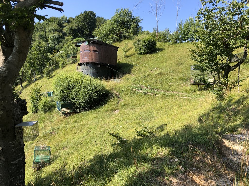
The next three photos show the traps to hunt migrating birds. I knew about this practice but not that it was so common. Very sad that things like this still happen in our modern Europe


Corna di Sonclino


Christian (Maria) country

Please take me with you

It was so hot and the sun was mercyless

The hermit of Eremo di San Giogio lived on top of that little hill

Santuario di Conche sadly it was closed to pilgrims because of Covid so I had to walk on
Finally after a long and hot day I arrived in Brescia
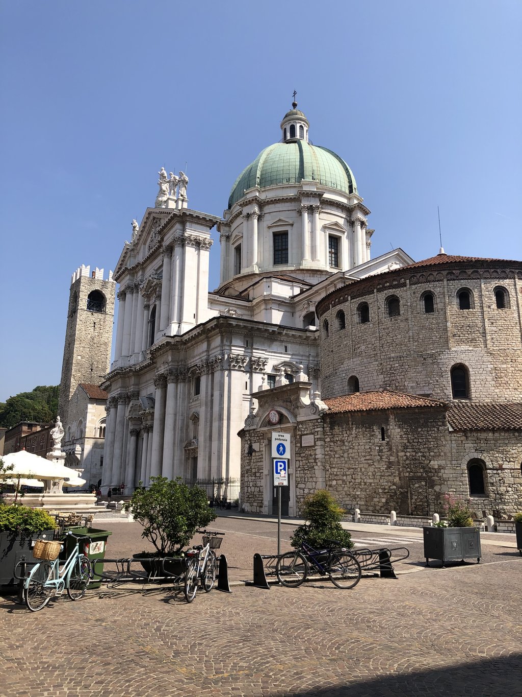
Day No.21- Brescia
During my day off in Brescia I did a bit of touristy sightseeing stuff and tried all the food and ice cream that I could


My last real Italian pizza
Day No.22- Journey home by train
Total distance was round about 400km.
I was not so lucky with the weather for the first part of the hike but the further I walked into Italy the better the weather.
Just have a look at the pictures and enjoy.
Day No.1- Garmisch Patenkirchen to the Kreuzeckhaus
After leaving Garmisch and heading up the mountains, I had the great feeling that holiday had started. It was pretty hot and humid and it did not take long for a rain shower with a bit of thunder and lightning to try and spoil my day. Well my mood was so good that the weather gods didn´t stand a chance. I took shelter under the roof of the Trögel Hütte and continued when it all was over.
The view after leaving Garmisch
Day No.2- Kreuzeckhaus to Knorr Hütte
Walking down towards Partnach valley was lovely and I was surprised to meet no one. The Partnach valley itself is just beautiful and is one of the places that you are not sure if this is really Germany. Especially the upper part of the valley with wonderful views were I came from are well worth the walk. After my first beer at the Knorrhütte I decided it was enough for the day and just enjoyed another beer and some good food.
Beautiful Reintalanger. Yes this is Germany
Day No.3- Knorr Hütte to Inntal (border crossing Germany/Austria)
A bit cold in the morning but after the sun came out it became a great day with almost no clouds and lots of sun. After a short hour walk, I crossed the border into Austria and felt privileged for living in this part of the world where you can cross borders without anybody checking. No hassle, no visas or special permits. Do all of us realize how lucky we are?
Anyhow, it was an easy walk down the Tillfussalm from where it went up for the next pass to go down towards the wide Inntal valley.
The Knorr Hütte early in the morning
View towards the nieder munde pass
The stream Leutascher Ache not far from the Tillfussalm
View from the nieder munde pass in the direction from where I came on the right side of the photo
The wide Inn Valley
Walking down into the Inntal it still looks pretty rough
Day No.4- Inntal to Kühtai
Yesterday from the top of the pass, it looked like a quick go towards the other side of the valley but it was almost noon until I reached Stams. From now on, it went all the way up to the top of the Pirchkogel. After coming down I found a nice place to pinch my tent and I decided that it was enough for that day.
Lovely Inn Valley early in the morning
I spend half the day hiking with Torben and Ties, photo taken close to the top of Pirschkogel
How beautiful this lake on the way down towards Kühtai
My camping spot
Day No.5- Kühtai to Winnebachsee Hütte
The first bit of the morning walk was still more or less ok. A bit further down I reached the Kühtai area where the landscape is “destroyed” just for the sake of skiing. After reaching the Finstertal reservoir, I was back in gentle alpine landscape again. Slowly the weather changed during the afternoon and it started to rain.
I reached the Winnebachsee Hütte in the clouds and was happy that they had a place to sleep for me and I could change for dry cloths and dry my wet stuff.
Next morning, I prefer hiking instead of horse riding
Kühtai, nice isn´t it?
On route towards Winnebachsee Hütte as the weather was still ok
Day No.6- Winnebachsee Hütte to Kaiseralm (Sölden)
Beautiful day and the it was a joy hiking. Close to the Amberger Hütte a farmer with a cow on the lease stopped me and asked if I could watch a new born calf that almost lay in a fast running stream.
Why do cows give birth at such a place?
Anyhow, the farmer came back 10 minutes later with a wheelbarrow and loaded the calf to take it to his “Alm”.
After the Amberg Hütte it went up towards the Atterkarjöchel. Not the most easy pass on the trail and I can imagine that people with fear of heights could end up being very unhappy.
After coming down I decided enough for today and I camped near a stream.
Winnebachsee Hütte early in the morning. Yesterday I almost bumped into the hut as it was barely seen due to rain and fog
Coming down the valley
Amberger Hütte
Above the Amberger Hütte
Last bit of glacier on my accent to the Atterkarjöchel
Not everybody’s favorite towards the top of the ridge
The ridge
View in direction of Kaiseralm
Preparing camp
Day No.7- Kaiseralm (Sölden) to Vent
This was the only day on the trail that I didn´t really like. Coming down towards Sölden was still ok, but the town itself was more like Disney Land to me. Between Zwieselstein and Vent some parts of the trail are along the road side which include tunnel crossing. Crazy like I am, I decided to do all on foot so there was no other option. I found a nice Pension in Vent and had a great pizza that made me forget all the negative moments along the road.
No need for comment
Sölden deep down the valley
No trespassing
On my way to Vent
My old school hotel in Vent
The hotel itself
Wauw that was a great fiesta at the end of the day
Day No.8- Vent to Bellavistahütte (border crossing Austria/Italy)
Nice early start with an early arrival at the Martin Busch Hütte. After a break, I continued for the highest part on the trail the Seikogel. Great views in all directions towards peaks and glaciers.
Ötzi the iceman was found not far from here and he crossed my mind quit a view times.
The last bit was a bit windy and I heard thunder from not too far away so I made a bit of a sprint towards the Bellavista Hütte.
An early start with great weather
Martin Busch Hütte in its lovely setting
Martin Busch Hütte again far down
Next few pictures are all from accent, top and decent of the Saykogel, the highest point of the whole trail. What will be left over of these glaciers in the next 10/20/30 years?
Punk is not dead!
Hiking up the valley towards Hochjoch
Day No.9- Bad weather resting day at Bella vista Hütte
Luckily, the bad weather hit me at this spot. What a great hut with a gorgeous kitchen and a special surprise, in the late afternoon the staff heats up a sauna.
Well I have seen and done a lot but never enjoyed a sauna on 2800 meters.
The Bella vista Hütte
My nice liitle room, luxury pure
Check out the sauna!
Day No.10- Bella vista Hütte to Schlanders (Süd Tirol)
This day I passed one of the most amazing lakes ever. Well just, check out the photos.
After that, it was half a day of decent towards Schlanders. I did not want to spend time looking for a place to stay in Schlanders so I filled up my water and found a great camping spot looking down on Schlanders.
The Vernagt Stausee
Where do these colours come from? Isn´t it beautiful? I spent quite some time just staring
After this lake called dark lake, it was down, down, down towards Schlanders
My camping spot close to Schlanders
Day No.11- Schlanders to Zirmbichlalm
A bit of a rainy day but looking back, it was not that bad, especially the humid smell of forest and alpine meadows was nature at its best.
Walking up towards the Göflaner alm there were boards showing how the men in this area had been transporting marble down the mountain from the quarries for over the last 150 years. Huge blocks that they moved down with their bare hands, rope and oxen. I was impressed and shocked at the same time. How many of these men died at this brutal job? What an easy life and safe live we have compared to them!
At the end of the afternoon, the sun came out and I found a nice camping spot.
Little impression of Süd Tirol
An even better impression for a hungry hiker
The weather was not too good that afternoon
Camping at Zirmbichlalm
Day No.12- Zirmbichlalm to Martell Hütte
An easy day of walk but kind of rainy. It would rain for half an hour and after that it would be dry again and then things would repeat. As the view was not very good for a glacier crossing and a just over 3000-meter pass I decided to stay in the Martell Hütte and hope for good weather for tomorrow.
After a rainy day I arrived at the Martell Hütte
Day No.13- Martell Hütte to Lago di Pian Palu
It started with an easy glacier crossing and the accent towards the Fürkel Scharte through some snow that fell last night. All in all nothing special except for the trail finding that was non visible because of the snow. Luckily, I met up with a German guy called Holger on the Hut so we shared our “fear” together. Funny thing that I realized later on was that by crossing this pass we finally left the German speaking part of the Alps and ended up in the Italian only speaking Alps.
And before I forget to mention it the weather was great and the sun shone all day!! Maybe something to do with the real Italy? Ohhhhh bella Italia
At the end of the day I decided to camp once more and Holger continued for the next Hut or???
I would never find out.
Leaving the Martell Hütte early that morning with snow on the higher regions
The crossing of a minor glacier on our way to the top of the Fürkler Scharte
This pass really divides the German/Italian language
Hiking down the pass with great weather towards the village of Peio
With a close look you can find rifugio Cevedale on the right side of the photo
This is what it is all about
After a long and easy walk down we arrived at the small village of Peio
Day No.14- Lago di Pian Palu to Ponte di Legno
It would be an easy walking day with the sun being my friend. By mid-afternoon, I reached Ponte di Legno and found a nice little hotel and enjoyed dolce vita for the rest of the day.
Lago di Pian Palu
Looking back from where I came from the Forcellina di Montozzo pass
First presence of the tragical fighting during the first world war
I had to go down all the way
Down on the valley floor lies Ponte Di Legno
My very very old school hotel in Ponte di Legno
Dolce vita on the town square
Day No.15- Ponte di Legno to Rifugio Tonolini
The first part of the day was not very spectacular as the walk went through a heavy populated valley. After leaving this urban jungle, it went up the mountains again to pass a few reservoirs that would not be the last ones that I would see in Italy. Seems that Italians loved to build reservoirs. Maybe they checked it out years ago that green energy would be the thing!
After the reservoirs, it went up towards a pass with a lot of boulder hopping and great views.
At the end of the day, I showed up at Rifugio Tonolini and had a nice cold beer.
On my way up to the Passo di Premazoni I passed quit a few reservoirs
Mount Adamello
Finally the top after a long scramble
Some great views
Refugio Tonolini at the end of the day
Day No.16- Rifugio Tonolini to lago di Avolo
This would be the longest but also one of the most beautiful days on the trail. I really enjoyed the rough landscape of the Adamello Mountains especially higher up with a feeling of being alone and lost in time. Walking down the Poja valley towards the Rifugio Lissone was a dream.
I was in such a (hiking) flow that I just continued without realizing that it would be a steep climb up from Rifugio Lissone. Late that evening I pinched my tent close to a little lake at roughly 2500-meters (I will never know the correct altitude because I am one of these old school guys without altimeter). The temperatures were slightly minus that night as all grass was white that morning but it was the best sleeping I had on the whole trail.
The small but cosy Rifugio Tonolini in the early morning
Just some nice views along the way
Rifugio Gnutti (they serve a great espresso)
The only way is up
Climbing passo Miller
Almost did it
View from passo Miller towards the other side
Adamello glacier
Rifugio Prudenzini at the bottom of the valley
Up the next pass called passo di Poia
Looking backwards with the Adamello glacier
This way down please
The lovely Poia valley
Last views of Rifugio Lissone
One of these secret moments
That is where I came from
More First World War relicts
After a long day, I pinched my tent close to this lake
Day No.17- Lago di Avolo to rifugio Tita Secchi
Great weather. Nice views. Couldn´t be any better.
High up in the mountains there are lots of hide outs as left overs of the fighting in these part of the alps during the first world war.
I have been seeing them since the last couple of days but the area of Tita Secchi is just full of them.
Here and there, I passed names of men that died during this crazy war. Many of them just boys, 15,16,17,18,19 years old!
The trail to Rifugio Maria y Franco passes below the snow on the right side of the photo
Looking back from where I came close to the Rifugio
Rifugio Maria y Franco with the next pass in the background
Smiling (because life is good) on top of the Dernal pass with Rifugio Maria y Franco in the far background
View from the Dernal pass in the direction where the trail leads me
Looking back towards the Dernal pass roughly in the middle of the horizon
Remains of the first world war
Rifugio Tita Secchi
Day No.18- Rifugio Tita Secchi to bivacco Capanna Tita Secchi
Slowly the hike is leaving the high Alps and I am entering the foothills of the Alps before they hit the Italian plains. Route finding gets more difficult and more than once, I need to back track.
Walking up the higher part of the valley of Grigna was just awesome, undisturbed nature all around me.
At the end of the day, I camped close to the bivacco Capanna Tita Secchi and enjoyed the last rays of sun eating some Italian cheese that I bought from a framer.
Yes, life can be very very good.
What a day! As you can see, I am slowly leaving the “high” Alps for the foothills
Maria everywhere
Laghi di Ravenola at the point where the Grigna valley opens up
Farmers milking their cows on the middle of the road close to bivacco Capanna di Tita Secchi. I am sure that these cows have a happy life
Day No.19- Bivacco Capanna Tita Secchi to Lodrino
I felt great, the weather was great and the surroundings looked great my inner feeling told me that I had to climb the Corna Blacca. It was a bit of a climb and half way up I thought why did I not take the easy trail?
However, it was worth every bit of energy that I wasted. That white Mountain, the magnificent views and the almost scary trails on the backside of the mountain.
I had only one word left over after I did it, great!
Coming down lower it was slowly getting warm and I was happy to be able to walk in the shade.
I reached the hamlet of Vaghezza and was more than happy to have a cold beer at the local (only) sportsbar. When I finally reached Lodrino I only wanted to drink a coke…I could barely remember that coke could taste sooooooo good.
I tried to find a hotel or B&B in lodrino but there was no Hotel and the only B&B was full or didn´t want smelly hikers for one night only so the only thing I could do was cry or carry on.
I decided the last one was the better option.
So I camped somewhere in the woods and the only thing I could say was HOT.
I had to be in the tent otherwise the mosquitos would eat me alive but the deal I made was in a little sticky tent with sweat just pouring out of me. This was definatly the worse night on the trip.
In the middle of the night, I had to scream to chase the wild pigs from the area.
Yes, that is what they call adventure…Why don´t you read stuff like that in these fancy looking magazines?
Sunrise as I just got out of my tent
My camping spot
The same view but just before setting of
Corna Blacca had to be climbed
Next few pictures during my accent and decent of Corna Blacca
The village of Lavino
Street in Lodrino
Again Lodrino
My camping spot
Day No.20- Lodrino to Brescia
The last day became extremely hot and more than once that day I thought what am I doing here?
I made a very early start to make sure that I could do the major part of the climb up the first pass with the still moderate morning temperatures. I was shocked by all the cages all along the mountaintops that hunters use to catch migrating birds. I mean, for sure couple of hundred years ago this was an important source of protein for the people of this area. But in our modern times with more and more animals and birds becoming extinct this is a “sport” that should be forbidden.
Anyhow, it was so hot that I filled up at every water source I could find and every time I did I would start off with about 4 liters of water.
I hoped to spend my last night as a pilgrim in the monastery of Conche but due to Covid it was closed.
Therefore, the only thing I could do was continue to Brescia were I arrived early that evening.
Finally, I could take a shower and change for something not so smelly.
The only sad thing was that I lost one of my flip flops so I got rid of the other one as well and I had to go town in my hiking boots.
Sunrise during my early start to try and avoid the heat
The next three photos show the traps to hunt migrating birds. I knew about this practice but not that it was so common. Very sad that things like this still happen in our modern Europe
Corna di Sonclino
Christian (Maria) country
Please take me with you
It was so hot and the sun was mercyless
The hermit of Eremo di San Giogio lived on top of that little hill
Santuario di Conche sadly it was closed to pilgrims because of Covid so I had to walk on
Finally after a long and hot day I arrived in Brescia
Day No.21- Brescia
During my day off in Brescia I did a bit of touristy sightseeing stuff and tried all the food and ice cream that I could
My last real Italian pizza
Day No.22- Journey home by train

 Die meinten, die andere Seite wäre auf jeden Fall fahrbar. Klettern kam nicht vor.
Kommentar